
Safe and Fuel-Efficient Motion Planning for Lunar Propulsive Drones
Elena Wittemyer, Graco Gao · N/A · 2026
Framework
N/A
License
N/A
Stars
N/A
Summary
Propulsive drones are a promising new technology for generating high-resolution terrain models of the Moon. In future lunar missions, propulsive drones will complete a series of hops across the lunar surface while capturing images with downward-facing cameras.
Abstract Summary
Key Points
- Propulsive drones are a promising new technology for generating high-resolution terrain models of the Moon.
- In future lunar missions, propulsive drones will complete a series of hops across the lunar surface while capturing images with downward-facing cameras.
- We present an autonomous motion planning framework that uses a vision-guided optimal control strategy for performing safe, efficient hops between specified waypoints.
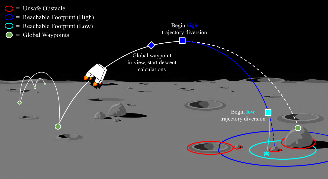
- The drone plans parabolic hops between waypoints generated by a global-level planner; if a nominal waypoint is unsafe or unreachable, the drone then completes a diversion maneuver to safely land.
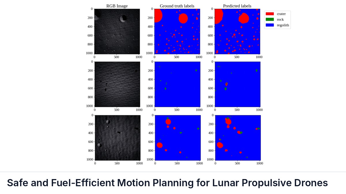
- To evaluate the validity of potential landing sites, we develop a custom semantic segmentation model for identifying obstacles from aerial images, and we introduce an approach for rapidly calculating reachable terrain.
Methods
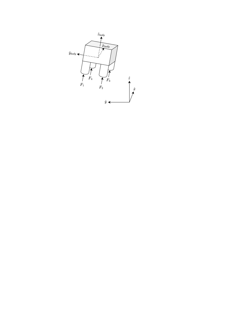
The upcoming MoonFall propulsive drones will have a diameter of about 2.1 m, a height of about 1.2 m, and a weight of about 250 kg [ 1 ] . We use these specifications as a starting point for our simulated drone. Our drone model consists of four cylindrical thrusters attached perpendicular to the base of a rectangular prism body, as shown in Fig. 2 .
Results
First, we report on the performance of our segmentation architecture. For our application, falsely identifying rocks/craters as regolith is more dangerous than falsely identifying regolith as rocks/craters, as we would rather unnecessarily avoid some terrain region than confidently land on an obstacle.
Moreover, for the purpose of picking a safe landing site, falsely identifying a rock as a crater or vice versa is harmless.
Sources and Demonstrations
Figures are reproduced from Wittemyer et al. See the full paper for experimental details and the project page, when the paper links one, for demonstrations and videos.
Related Papers
A Low-Cost, Open Platform for End-to-End Autonomous Driving on a Miniature Ackermann Vehicle
Gustavo Claudio Karl Couto, Eric Aislan Antonelo, Gabriel George Zipperer
This paper presents a low-cost, open experimental platform for research in end-to-end autonomous driving with miniature Ackermann vehicles.
Adaptation Needs in Robotic Systems: Assessing Behavior Trees and Their Enhancement
Mehran Rostamnia, Gianluca Filippone, Ricardo Caldas et al.
Robotic systems increasingly operate in dynamic, uncertain, and open-ended environments, where design-time assumptions may no longer hold, and adaptation becomes necessary to maintain effective and safe operation.
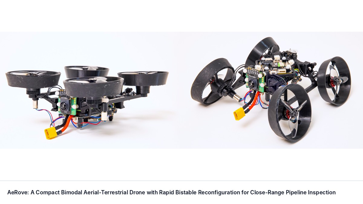
AeRove: A Compact Bimodal Aerial-Terrestrial Drone with Rapid Bistable Reconfiguration for Close-Range Pipeline Inspection
Caleb Polillio, Petras Swissler
Close-proximity pipeline inspection is challenging for standard drones due to high hovering power consumption, airflow sensitivity, and propeller wash interference with gas sensing. To address this, we present AeRove, a compact bimodal aerial-terrestrial robot.

Aim Short to Reach Far: Your Frozen World Model Can Plan Better Than You Think
Xvyuan Liu, Jianjie Fang, Chen Gao et al.
Planners built on visual world models commonly score each predicted outcome by its distance to the encoded goal image. We show that this target can limit control even with exact dynamics and globally optimal short-horizon search: reaching a goal may require actions that initially move away from it.