
GLIO2: A GPU-Parallelized Tightly-Coupled LiDAR-Inertial-GNSS System for Robust and Real-Time Global Localization and Mapping
Qi Zhang, Xikun Liu, Qijun Qin, Xiangru Wang, Junzhe Wang, Naigui Xiao, Jianhao Jiao, Weisong Wen · N/A · 2026
Framework
N/A
License
N/A
Stars
N/A
Summary
Globally consistent, real-time state estimation in large-scale, perceptually degraded environments is essential for autonomous vehicles and aerial robots, and requires fusing LiDAR, inertial, and GNSS measurements.
Abstract Summary
Key Points
- Globally consistent, real-time state estimation in large-scale, perceptually degraded environments is essential for autonomous vehicles and aerial robots, and requires fusing LiDAR, inertial, and GNSS measurements.
- Existing fusion methods, however, share a scan-to-map front-end with two failure modes
- First, each scan is aligned to an incrementally built map that drifts under degeneracy, and once the estimate diverges the error is irrecoverable.
- Second, even without divergence, a registration biased by dynamic objects or wrong correspondences is propagated as a single pose constraint with an over-confident covariance, leaving its correspondences unavailable for GNSS to re-weight or relinearize.
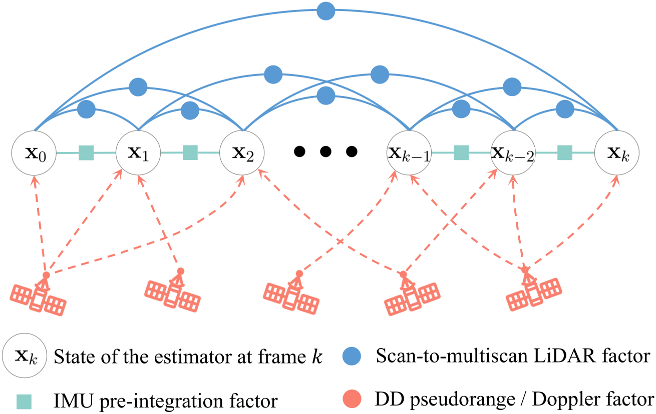
- We propose GLIO2, a tightly-coupled LiDAR-Inertial-GNSS system whose GPU-parallel front-end jointly optimizes scan-to-multiscan LiDAR, IMU pre-integration, and raw GNSS measurements in a single sliding-window factor graph, sustaining real-time operation on edge hardware.
System Overview
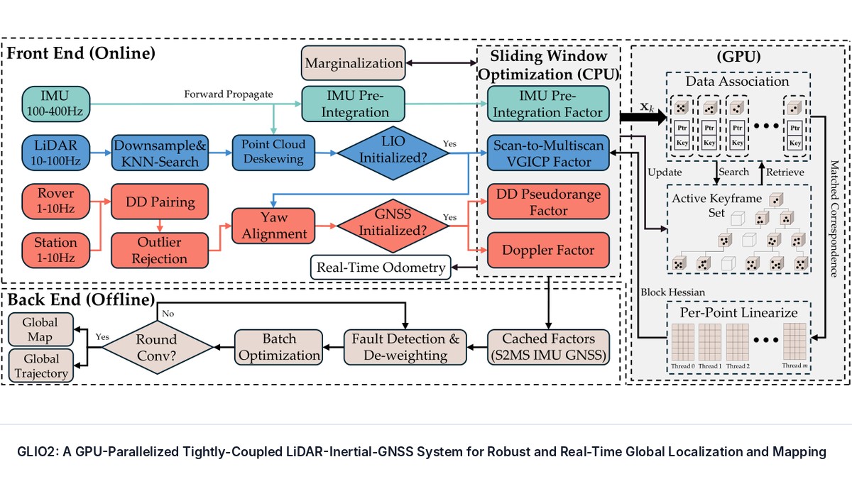
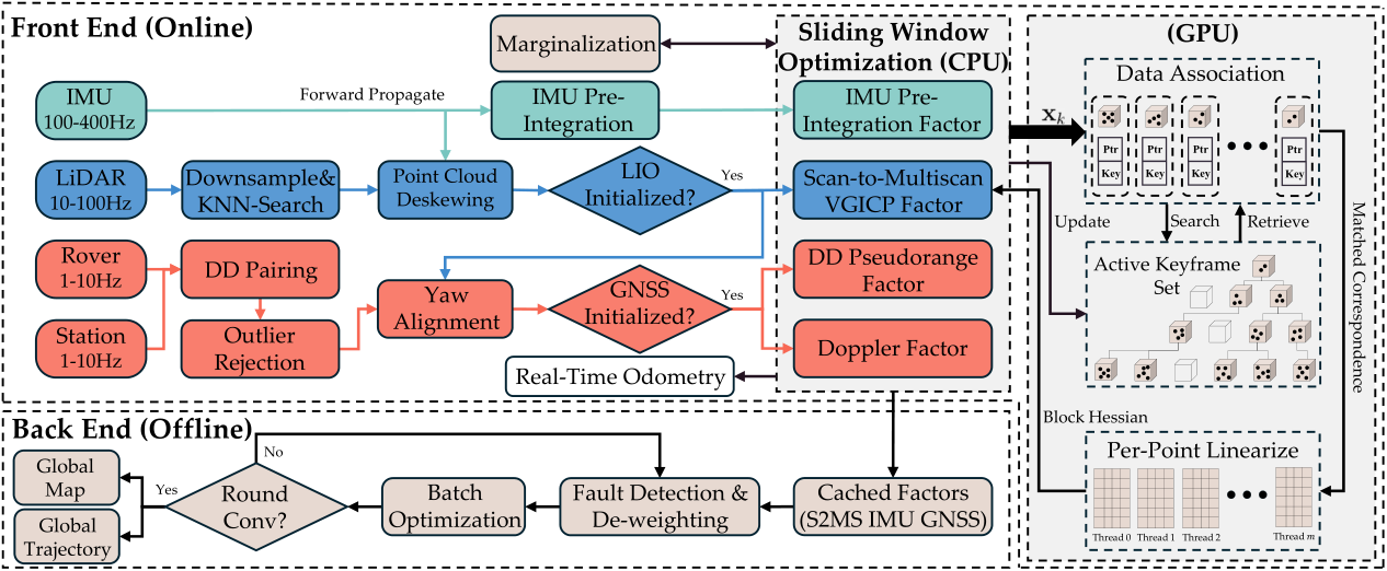
The overview of GLIO2 is shown in Fig. 2 . GLIO2 fuses three asynchronous streams, LiDAR, IMU, and raw GNSS from the rover and a reference station, in a single tightly-coupled factor graph (Sec. 4 ). The methodology comprises the factor graph formulation (Sec. 4-4.1 ), the four measurement factors (Sec. 4-4.2 – 4-4.5 ), the active keyframe set (Sec. 4-4.6 ), marginalization (Sec. 4-4.7 ), and initialization (Sec.
4-4.8 ) of the online front-end, and the global batch optimization of the back-end (Sec. 4-4.9 ).
Methodology
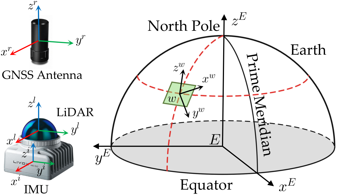
The optimal state estimate is obtained by solving a Maximum A Posteriori (MAP) problem. Assuming that all sensor measurements are independent and their associated measurement noise follows a zero-mean Gaussian distribution, the MAP inference is equivalent to minimizing the sum of squared Mahalanobis distances of the residuals.
Experiments
We evaluate GLIO2 on both public datasets and our self-collected dataset. The public datasets (UrbanNav [ 10 ] , MARS-LVIG [ 11 ] , and M3DGR [ 12 ] ) benchmark GLIO2 against state-of-the-art LiDAR–Inertial–GNSS systems (Sec. 5-5.25.2.1 ).
The self-collected dataset targets the two failure modes this work addresses, raw GNSS denied or NLOS and LiDAR geometric degeneracy, across four sequences ( Urban , Switch , Bridge , and Plain ) (Sec. 5-5.25.2.2 ), and drives the ablation study that isolates the contribution of each module (Sec. 5-5.3 ).
Applications
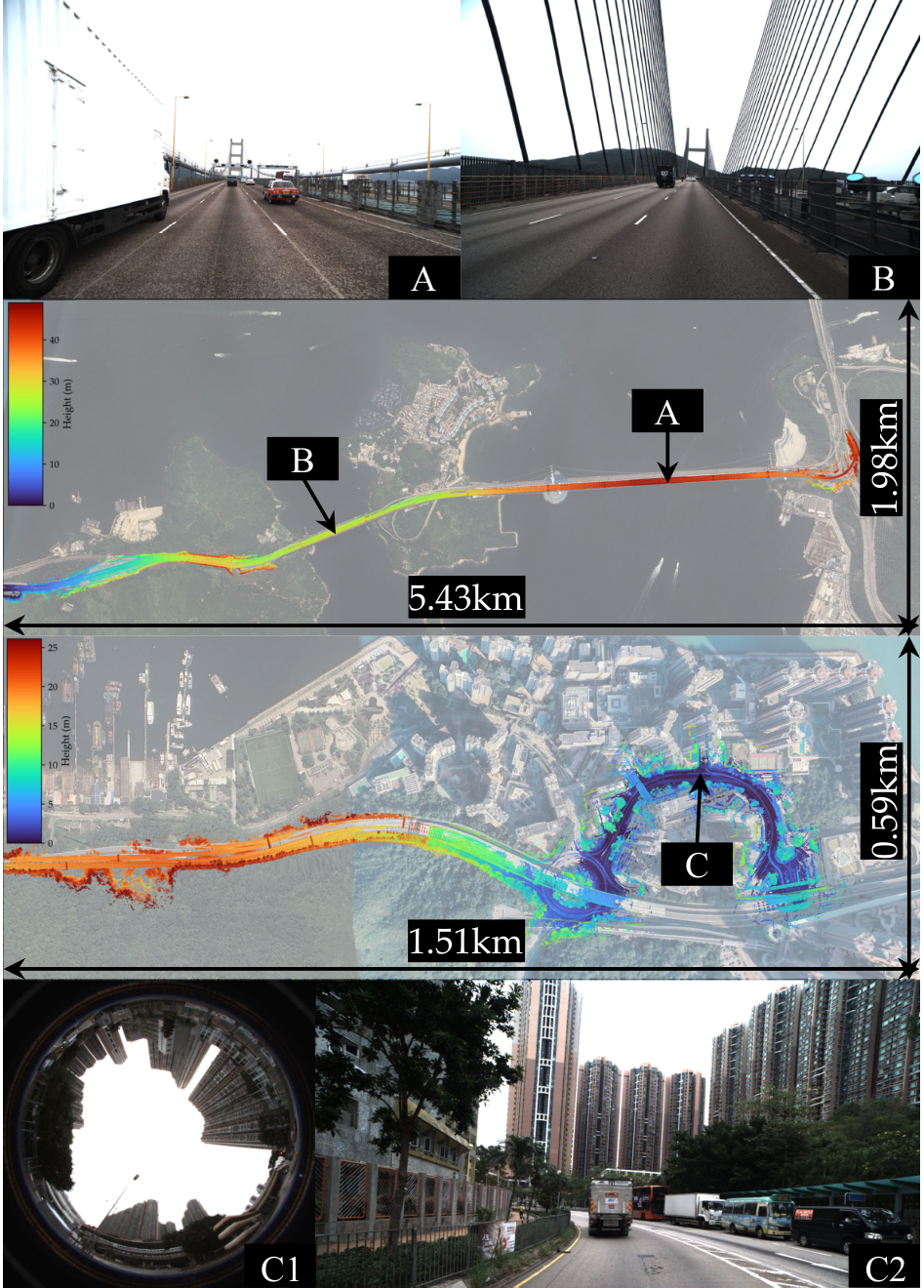
To demonstrate the practicality of GLIO2 in real-world tasks, we deploy it as the sole onboard localization and mapping source in two complete autonomous systems: a facade-cleaning UAV and a guide-dog quadruped for the visually impaired.
Together they stress the three properties the estimator is built for: robustness under simultaneous LiDAR and GNSS degradation, global consistency over a long map-referenced route, and real-time operation fully onboard.
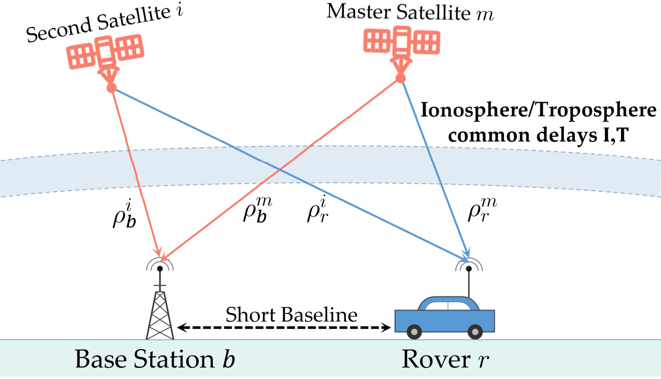
GNSS Factor Jacobians
All Jacobians below use the unit line-of-sight vector $\mathbf{e}_{r}^{s}$ of ( 10 ), pointing from the receiver to satellite $s$ (Table 2 ); the geometric-range derivative is then $\partial\/{}^{E}\mathbf{p}^{s}-{}^{E}\mathbf{p}_{r}\//\partial{}^{E}\mathbf{p}_{r}=-(\mathbf{e}_{r}^{s})^{T}$. The Jacobians of the DD pseudorange residual $r_{\rho}^{mi}$ (Sec.
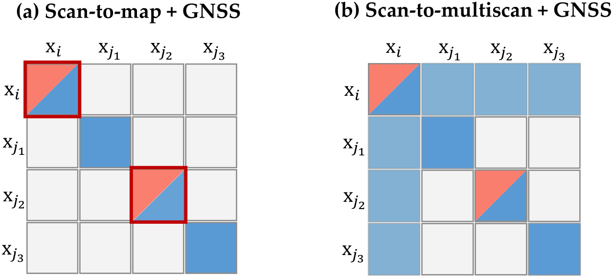
Single-Receiver Pseudorange Factor
On datasets without a reference station (e.g. M3DGR), the double-differenced pseudorange factor of Sec. 4-4.2 is replaced by an undifferenced single-receiver factor built directly on the raw pseudorange model ( 4 ).
Because differencing no longer cancels the receiver clock offset, the per-constellation offset $\boldsymbol{\delta t}_{r}\in\mathbb{R}^{4}$ is reinstated as a navigation-state variable in this variant (its drift rate $\boldsymbol{\dot{\delta t}}_{r}$ is retained as before).
Sources and Demonstrations
Figures are reproduced from Zhang et al. See the full paper for experimental details and the project page, when the paper links one, for demonstrations and videos.
Related Papers

3D Euler-Angle Orientation Control for Two-Ray Fading Mitigation in Maritime Air-to-Sea Communications
Mohammed Bajja, Abdoul Karim A. H. Saliah, Hajar El Hammouti et al.
Maritime Air-to-Sea links are dominated by a line-of-sight ray and a sea-surface reflected ray whose destructive combination produces deep fades. Existing mitigation strategies optimize Unmanned Aerial Vehicle position or trajectory but leave attitude unexploited.
4D Radar Perception Algorithms for Autonomous Driving: A Review
Xumin Wu, Jun Zhou, Jilin Mei et al.
Research on 4D millimeter-wave radar perception algorithms has flourished in recent years, extending from signal processing and object detection to semantic segmentation, motion estimation, occupancy prediction, and dynamic scene reconstruction.
A Browser-Native Digital Test Range for Benchmarking 4D Ocean-Glider Planning Algorithms
Edward Holmberg, Elias Ioup, Mahdi Abdelguerfi
Repeated in-situ evaluation of ocean-glider planners requires scarce vehicles, operators, deployment and recovery resources, and ocean conditions that cannot be reset for competing algorithms.
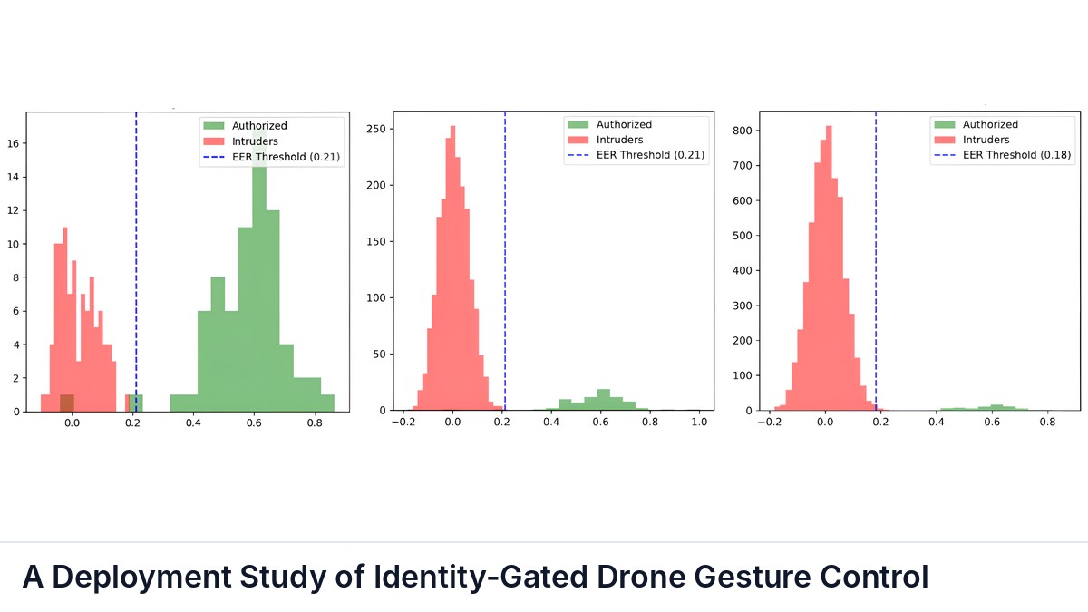
A Deployment Study of Identity-Gated Drone Gesture Control
Diyari Mohammed Salih, Ilyes Chaabeni, Naima Ait Oufroukh
Vision-based gesture control accepts commands from any hand in the camera field of view, which is unsafe in shared indoor spaces.