
Human-in-the-Loop Geospatial Annotation for Rapid Dataset Construction in Field-Deployed UAV Systems
Morgan Masters, Nikolaas Bender, T. Luca Altaffer, Colleen Josephson, Steve McGuire · N/A · 2026
Framework
N/A
License
N/A
Stars
N/A
Summary
Real-world perception systems must adapt to changing environments, but manual image annotation cannot scale to field data volumes.
Abstract Summary
Key Points
- Real-world perception systems must adapt to changing environments, but manual image annotation cannot scale to field data volumes.
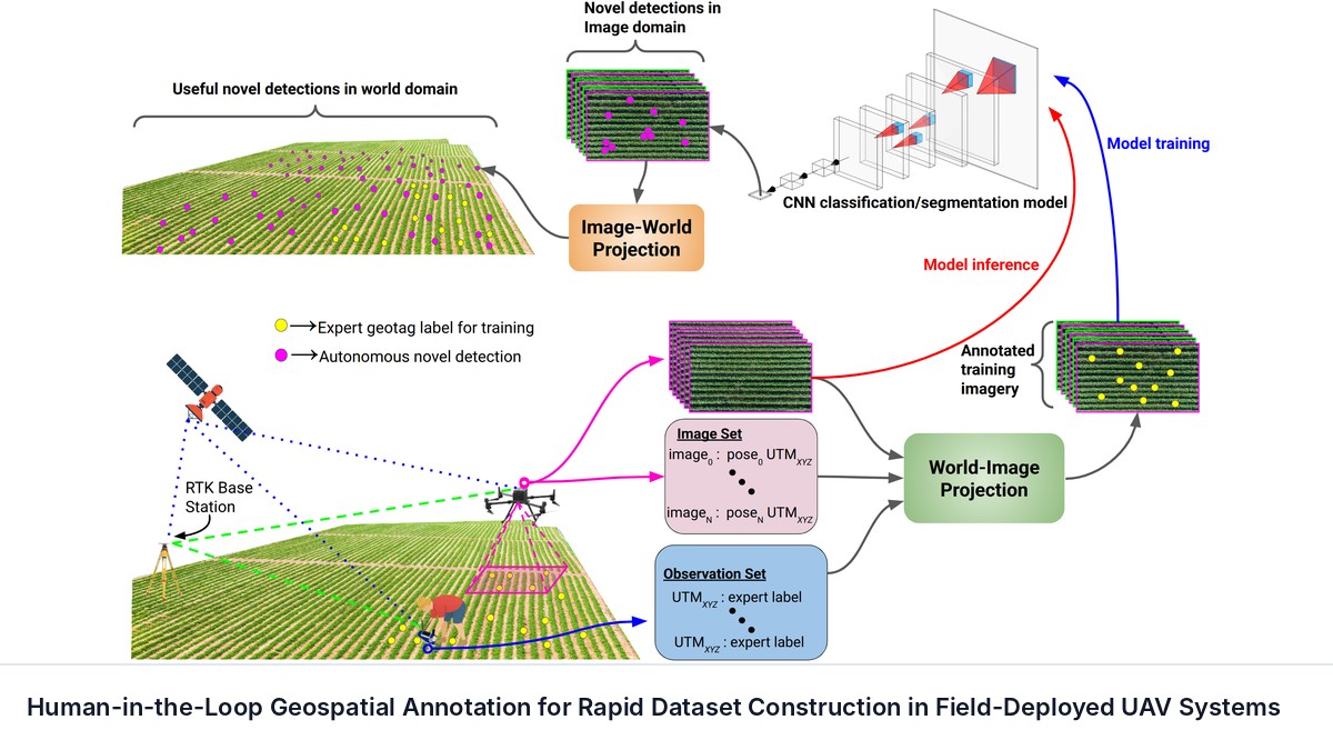
- We present BirdsEye, which shifts expert annotation from images to the field: an operator records target locations in world coordinates using RTK positioning and calibrated projective geometry propagates each observation to all frames where the target is visible.
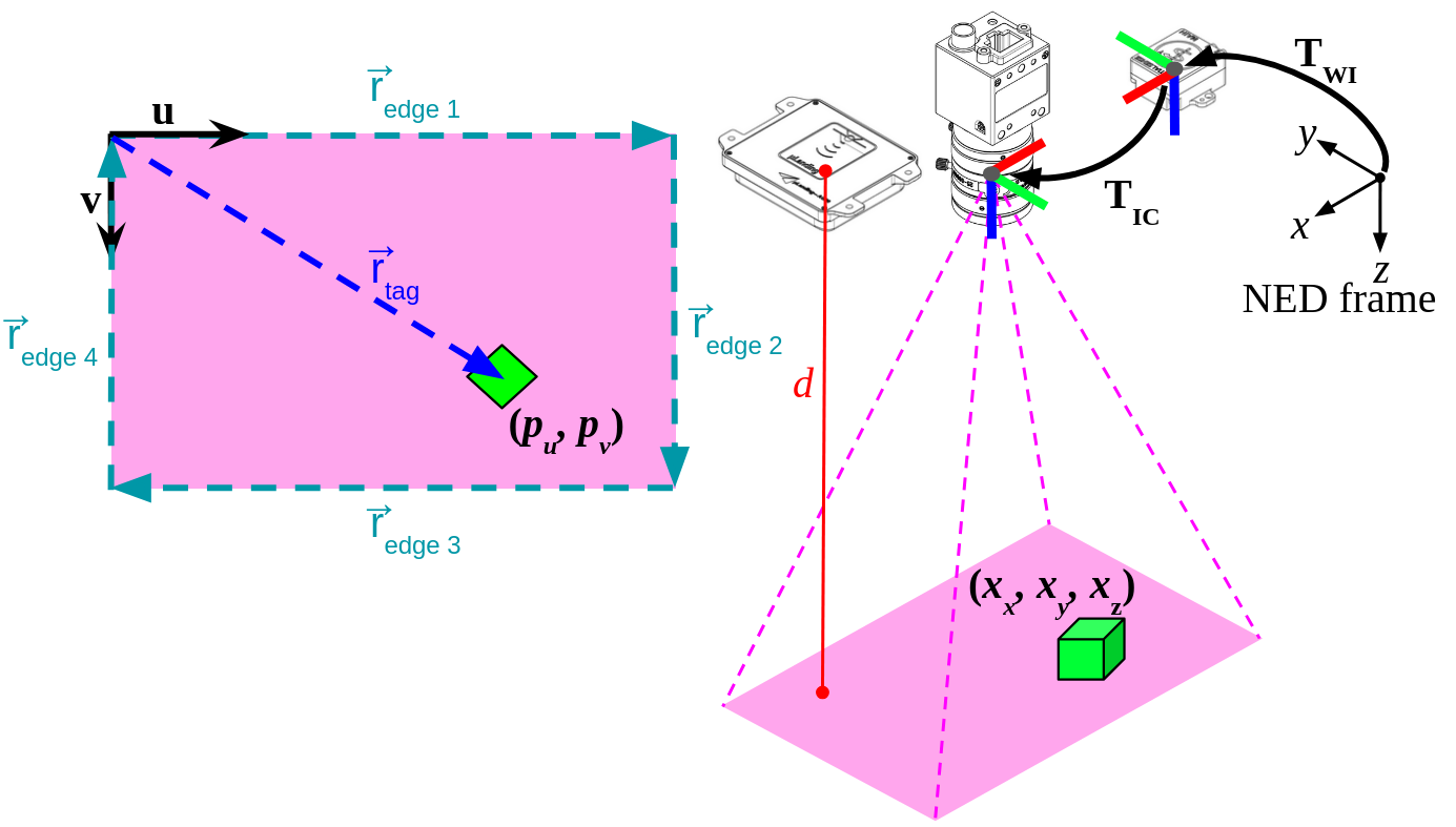
- To quantify how well physical annotations align with image observations, we derive a first-order mapping from camera-pose uncertainty to pixel uncertainty and validate it against Monte Carlo simulation.
- This mapping is linear in the six per-axis pose variances, so it inverts into a sensor design tool: we give a sufficient condition converting an annotation tolerance into a convex set of admissible pose-noise budgets, a closed-form largest admissible scaling of a deployed sensor suite, and a unique per-axis pose specification under an equal-budget-share allocation.
- We also analyze the planar-surface approximation underlying the projection, which holds up to 10 degrees of terrain slope.
Materials and Methods
[node distance=1cm and 2cm] block = [rectangle, rounded corners, minimum width=3.2cm, minimum height=1cm, text centered, draw=black, fill=blue!20] \tikzstyle source = [rectangle, rounded corners, minimum width=3.5cm, minimum height=1cm, text centered, draw=black, fill=red!30] \tikzstyle sensor = [rectangle, rounded corners, minimum width=3.5cm, minimum height=1cm, text centered, draw=black, fill=green!30] \tikzstyle network = [rectangle, rounded corners, minimum width=3.5cm, minimum height=1cm, text centered, draw=black, fill=orange!30] arrow =...
Results
To quantify system projective accuracy, we designed a validation procedure using geotagged AprilTag targets in a flat, level environment. This setup provides both pixel-space ground truth via AprilTag detections and world-frame ground truth via geotag RTK GPS positions, enabling comprehensive evaluation of both pixel and geospatial projection fidelity.
† The data of this table gives estimates of our effective GSD at both test altitudes: 2.219$\pm$0.138 mm @ 10 m; 4.376$\pm$0.021 mm @ 20 m.
Sources and Demonstrations
Figures are reproduced from Masters et al. See the full paper for experimental details and the project page, when the paper links one, for demonstrations and videos.
Related Papers
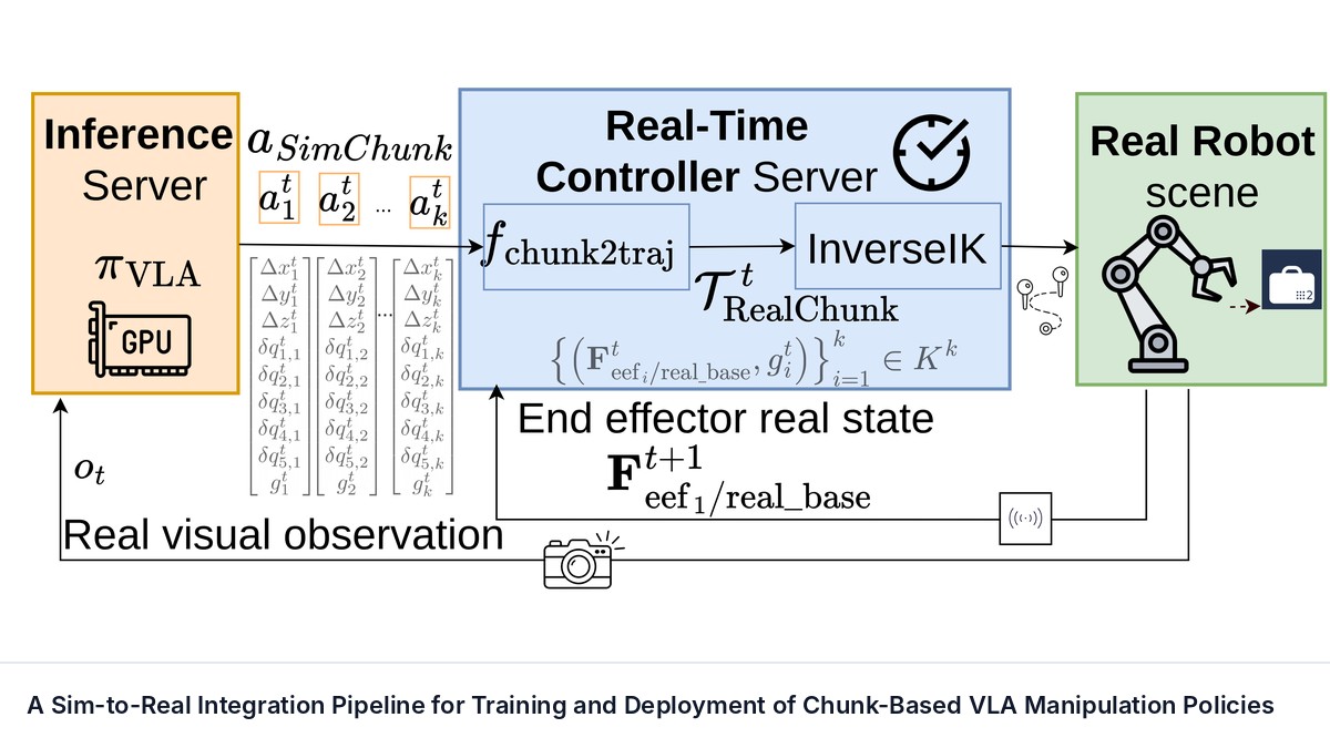
A Sim-to-Real Integration Pipeline for Training and Deployment of Chunk-Based VLA Manipulation Policies
Mathilde Kappel, Clémence Grislain, Mohamed Chetouani et al.
Vision-Language-Action (VLA) models have become a prominent paradigm for mapping multimodal inputs, including semantic instructions, visual observations of the scene, and proprioceptive observations, to robot actions.
Aim Short to Reach Far: Your Frozen World Model Can Plan Better Than You Think
Xvyuan Liu, Jianjie Fang, Chen Gao et al.
Planners built on visual world models commonly score each predicted outcome by its distance to the encoded goal image. We show that this target can limit control even with exact dynamics and globally optimal short-horizon search: reaching a goal may require actions that initially move away from it.
Beyond Reconstruction: What Matters in Action Tokenization for Robot Policies?
Haoran Chen, Jingtian Ji, Samuel Wheeler et al.
Autoregressive action-token policies such as vision-language-action models require action tokenizers to translate discrete token sequences into precise control actions in continuous space. Many action tokenizers learn the mapping between tokens and actions via a reconstruction objective.
Capability-Aware Arbitration for Semantic Intent-Based Shared Control
Zhaoda Du, Michael Bowman, Xiaoli Zhang
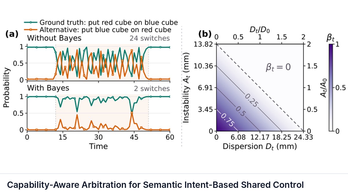
Shared control often allocates robot authority based on confidence in inferred human intent, assuming reliable autonomous execution. When this assumption fails, high intent confidence can cause over-helping.